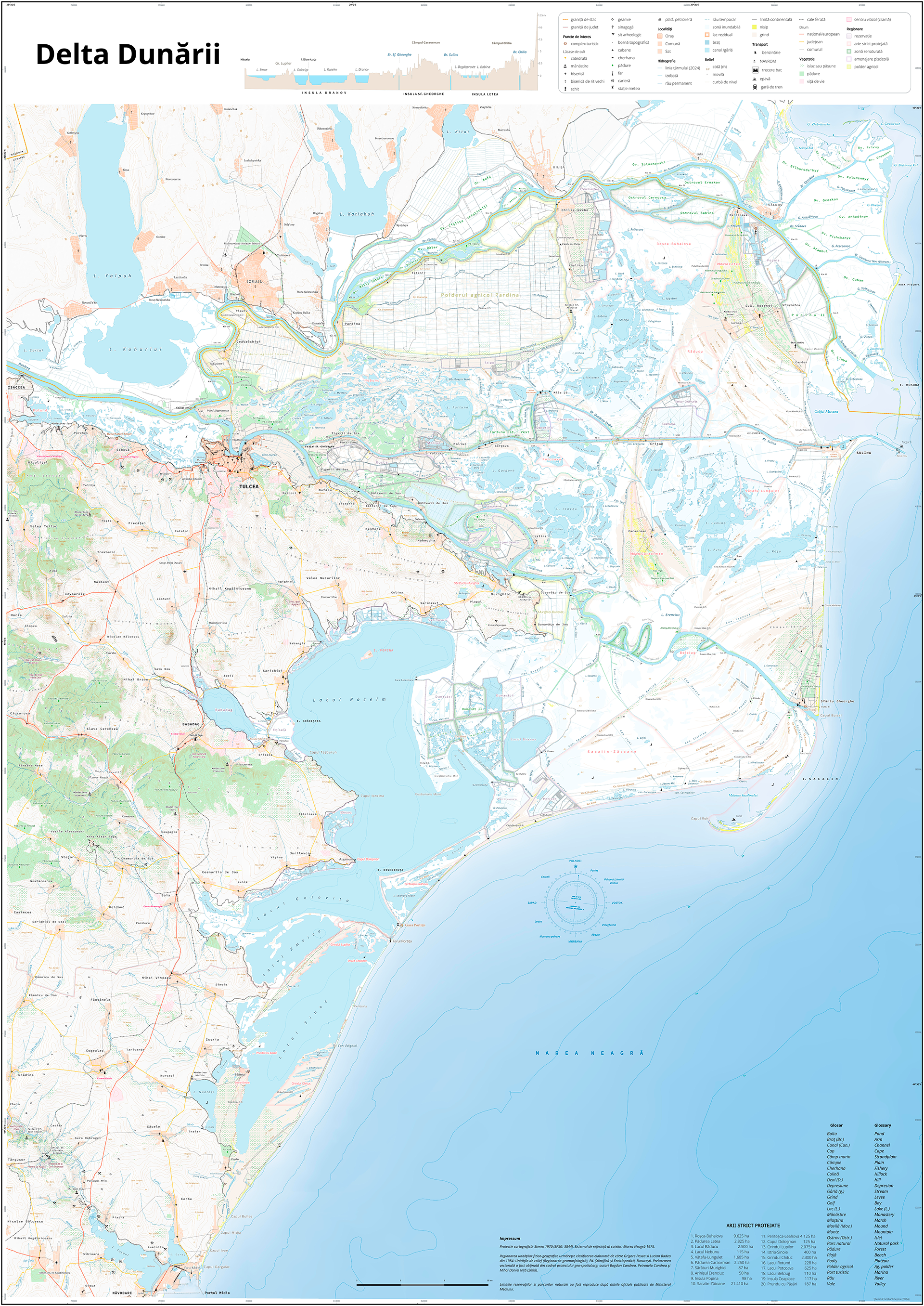
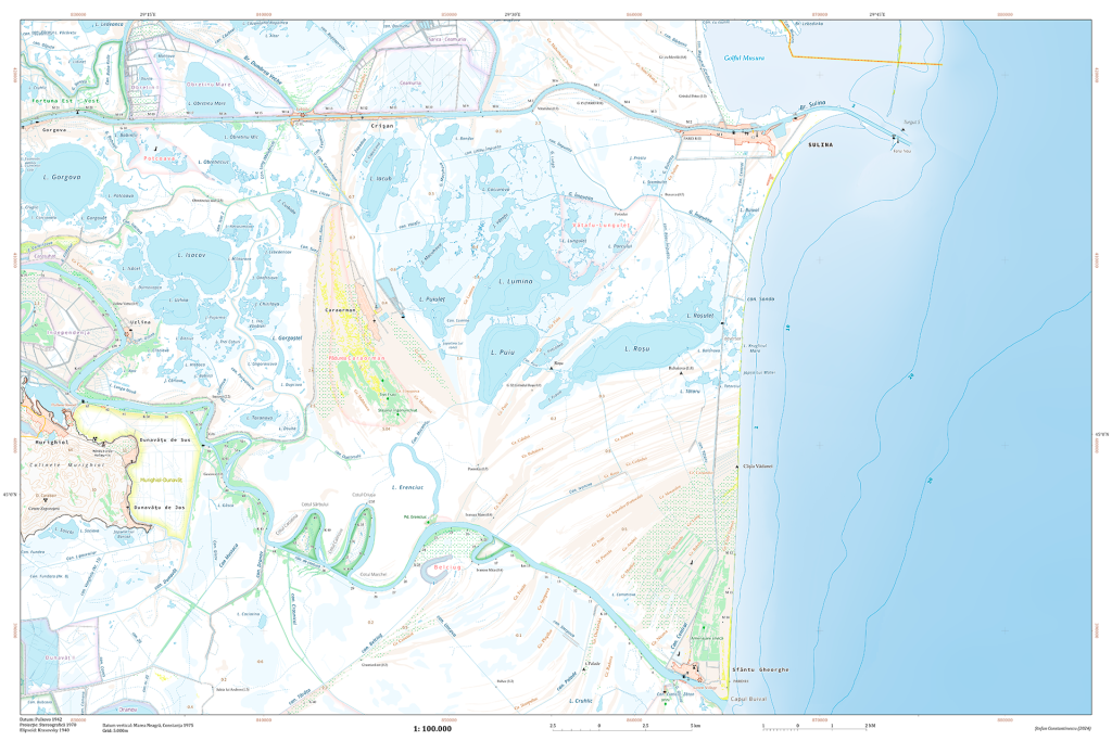
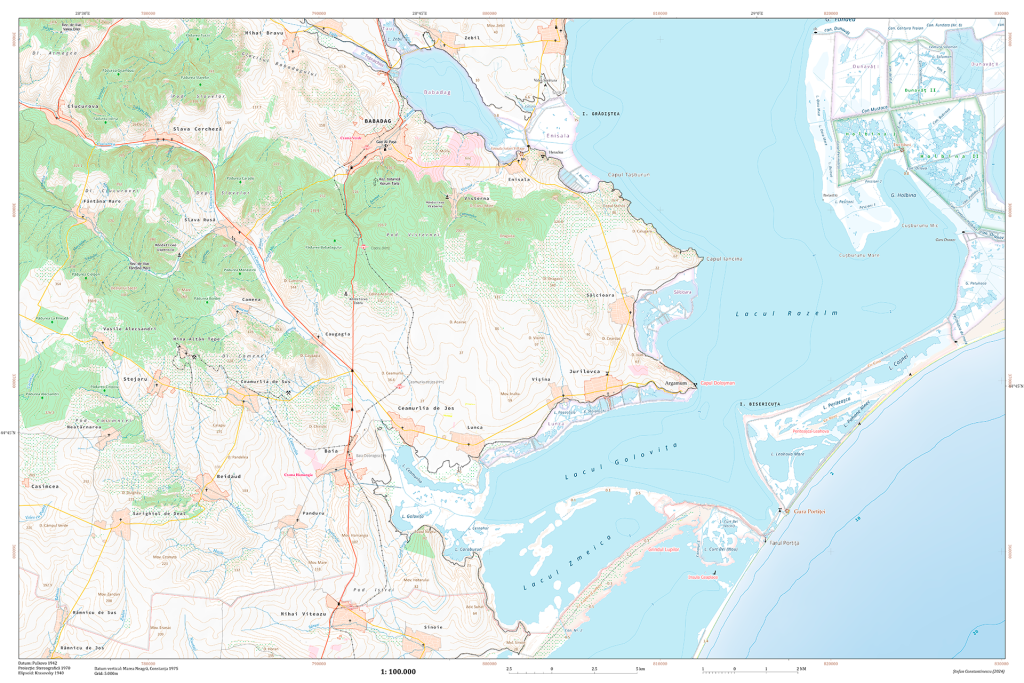
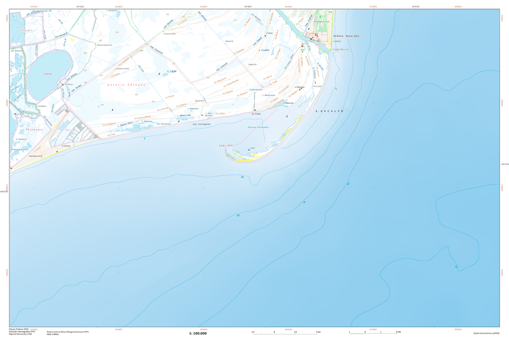
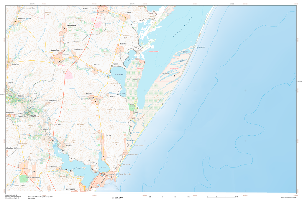
The Danube Delta map represents an ongoing cartographic endeavor, one that will always have room for refinement.
The images above are designed as an alternative resource to the wealth of existing information available on digital platforms such as Google Maps, Apple Maps, and OpenStreetMap. Their purpose is not to replace these resources but to complement them. All datasets have been created by our team, with many toponyms verified on-site in collaboration with local residents.
This map is intended to serve both tourists and researchers conducting activities in the deltaic environment.
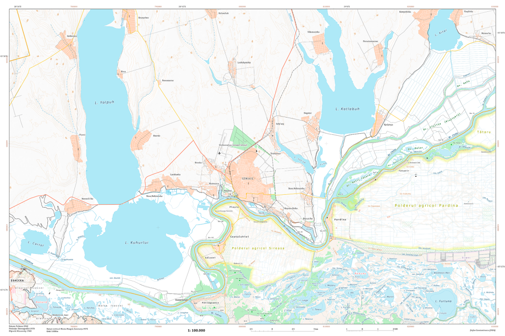
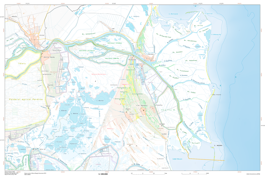
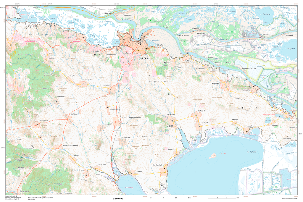
The seven individual sheets, produced at a scale of 1:100,000, are specifically tailored for field use, particularly for navigating the delta’s channels and waterways by boat. These sheets may be laminated with waterproof transparent plastic to ensure durability and usability in various conditions, especially during educational activities involving groups of students.
Like any map, these remain a work in progress and are part of our ongoing project for continuous improvement. Feedback is crucial in refining and enhancing their quality, and we greatly value your input.